
Tukwila ZIP Coverage at a Glance
The official King County western ZIP boundary map shows six numbered codes relevant near Tukwila, plus a separately marked PO-box designation. These codes overlap postal areas associated with Seattle, SeaTac, Renton, and Kent. The table is a boundary research aid, not a statement that every address in each code lies inside Tukwila. Check each street against current USPS results and the city-limit layer.
| ZIP Code | Areas Covered | Post Office | Notes |
|---|---|---|---|
| 98032 | Kent postal area by the southeast and Southcenter region | Verify through USPS | Do not equate the ZIP with Tukwila |
| 98057 | Renton postal area at the north and east edge | Verify through USPS | Parcel and city-limit checks required |
| 98108 | Seattle postal area near northern industrial and Allentown edges | Verify through USPS | Search Tukwila and Seattle labels |
| 98168 | Seattle, SeaTac, and Tukwila boundary area | Verify through USPS | Common cross-boundary code |
| 98178 | Seattle postal area near the eastern edge | Verify through USPS | Possible overlap, not city proof |
| 98188 | Central, southern, and Southcenter area with SeaTac and Seattle labels | Verify through USPS | Compare delivery city and city limit |
| 98138PO | Postal-only designation on the county map | PO-box service | No street-delivery inference |
The map is dated January 2013, so it should not overrule a current USPS address result. No official ZIP realignment history or stable address-level crosswalk was found. Preserve that limitation. A postal code can be useful for narrowing records while still being too broad to identify a city, neighborhood, or person.
Tukwila Postal Names Cross Borders
Postal geography follows delivery operations, not incorporation lines. The same Tukwila-area address can be described with a recognized postal city, a current municipality, a neighborhood, and a historical jurisdiction. The official city neighborhood map names Allentown, Cascade View, Duwamish, Foster, Foster Point, McMicken, Riverton, Thorndyke, Tukwila Hill, Tukwila South, Tukwila Urban Center, and Ryan Hill. None is interchangeable with a ZIP.
This matters most near the city edge. A Seattle, SeaTac, Renton, or Kent postal label does not settle whether the parcel falls within Tukwila. The reverse is also true: a Tukwila mailing label cannot prove municipal jurisdiction. Match the address to a mapped parcel, then inspect city limits and the historic date.
Note: Keep postal city, municipality, neighborhood, and historic jurisdiction in separate fields rather than forcing one label to answer every question.
Search Tukwila ZIP Codes with USPS
The USPS ZIP Code Lookup offers three distinct paths. Use the address path to normalize a street, the city-and-state path to list codes associated with a postal city, or the ZIP path to see recognized cities. USPS warns that a returned ZIP does not confirm that a person or company is present.
| USPS search path | Required fields | Optional fields | What it answers |
|---|---|---|---|
| By Address | Street address, city, state | Company, unit, ZIP | Normalized delivery information |
| By City and State | City and state | None documented | ZIP codes recognized for that postal city |
| Cities by ZIP | ZIP | None documented | Recognized or recommended postal city names |
The successful ZIP image in the manifest shows the empty USPS lookup controls, with no resident data entered.
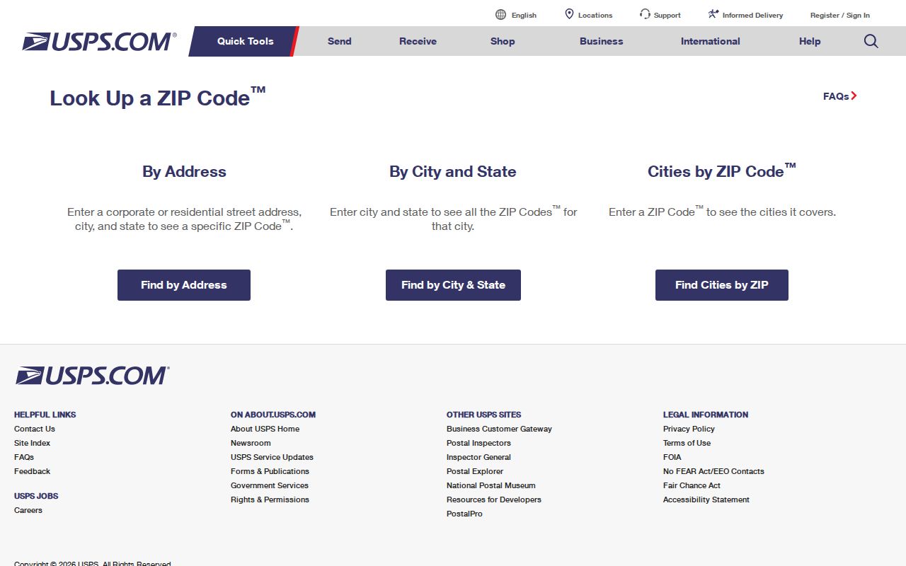
The controls help verify how mail is addressed. They do not establish municipal residence, ownership, or identity.
Find Tukwila Residents Within a ZIP
A ZIP code directory can define a starting region, but the official tools do not provide one unrestricted list of every person in a code. Begin with a specific name, address, or parcel. eReal accepts parcel, address, or property-name searches after its public-records acknowledgement. Parcel Viewer accepts an address or parcel and links to the assessor report. The personalized voter tools require exact matching values and are not ZIP-wide browsing tools.
- Enter the full address in USPS and save the normalized street, postal city, state, ZIP, and unit treatment.
- Search the same address in King County Parcel Viewer and record the parcel number and mapped municipality.
- Open eReal for current owner or taxpayer display, value, sales, legal description, and property characteristics.
- For a voter checking their own record, use King County My Voter Information with three exact matching values.
- If the search moves to a named street, use the Tukwila street directory workflow for street-level sources.
The Washington voter database extract has its own request process, public-field limits, and restrictions. Public voter data generally includes name, address, year of birth, voting history, and precinct or district information. Full birth date, driver-license data, the last four Social Security digits, and protected information are not public. A ZIP is therefore one field in a controlled record, not a shortcut around access rules.
Four Tukwila Location Layers Compared
Tukwila ZIP code searches work best when each system is allowed to answer its own question. One address can yield several valid labels because each custodian manages a different layer.
| Layer | Official source | Reliable use |
|---|---|---|
| Postal delivery | USPS | Normalize the delivery address and recognized postal city |
| Parcel and situs | King County Assessor and Parcel Viewer | Find tax parcel, situs, legal description, and mapped property facts |
| Municipal geography | Tukwila iMap | Check city limits, streets, buildings, and annexation context |
| Voter residence | King County Elections and VoteWA | Personalized registration and district information under voter rules |
A mismatch is not proof of an error. It is a signal to record the date, source, and exact wording. Tukwila's city line, USPS delivery geography, voter residence, and assessor situs can change on different schedules.
Map Tukwila ZIP Edges Carefully
The Tukwila City Maps page links to iMap, GIS Open Data, a Development Viewer, a capital-project dashboard, historic-preservation tools, and annexation history. The Core MapServer provides address, street, building, and city-limit layers. The Community MapServer adds neighborhoods, landmarks, schools, school districts, and voting districts. Those layers can be queried, identified, or exported, but they do not contain a public roster of residents.
King County Parcel Viewer adds parcel geometry and links to eReal and district or development-condition reports. Use a parcel boundary as the bridge between the mailing address and municipal map. Near Ryan Hill, Foster, Allentown, Southcenter, and the Duwamish corridor, also check annexation history before assigning an older record to Tukwila.
The map tools supply civic geography, which should be compared with the postal result rather than substituted for it. Keep a link to the official map page in the research ledger so the boundary can be checked again.
Tukwila ZIP Boundaries and City Limits
A ZIP boundary is drawn for mail service. Tukwila's city limit marks municipal jurisdiction. King County's parcel map identifies tax parcels, while a voter record describes registration under election law. These edges overlap imperfectly. An address in a code associated with Tukwila may sit outside the city, and a parcel inside Tukwila may use another recognized postal city.
- ZIP Code
- A five-digit USPS delivery area that does not necessarily match a city boundary.
- ZIP+4
- A more precise delivery segment appended to the five-digit code.
- PO-box ZIP
- A postal designation for boxes, not a mapped set of street residences.
- Unique ZIP
- A code assigned for a high-volume organization; none was confirmed for Tukwila research.
- Carrier route
- A mail-delivery path that can cut across other civic or statistical boundaries.
For historical work, add the record year. Tukwila incorporated in 1908 and later annexations changed the city edge. Ryan Hill and Foster history can send an older address to a different custodian even when its current ZIP and city label look clear.
Build a Tukwila ZIP Address Ledger
Save each version of an address instead of replacing the old form. A compact ledger should include the original source string, normalized street, unit, USPS city and ZIP, parcel number, current municipality, historical municipality, date checked, and a confidence note. Add the legal description when a deed or long property timeline is involved.
This method protects against false matches. A name tied to 98188 in one source and a Tukwila parcel in another may refer to the same place, but the source dates and exact street still need to align. Retain diacritics, alternate name order, and spelling variants where official search fields allow them. Tukwila's multilingual population makes exact transcription especially important, yet a surname alone never proves identity.
Tukwila ZIP Lookup Fallbacks
When an online form fails, use the custodian that owns the layer. USPS handles current delivery format. King County Assessor and GIS handle parcels. Tukwila Community Development handles permits and city property files through its viewer and records routes. King County Elections or VoteWA handles personalized voter information. The City Clerk accepts general city requests online, by email, fax, mail, and at the counter.
A public-records request must seek an existing record. It does not require an agency to create a ZIP-wide resident database. Give the office the exact address, date range, record type, and parcel or permit number when known. For older boundary questions, add the historical community label and annexation date range. Library and archive staff can help with old maps or directories when a current portal has no historical view.
Note: Date every ZIP code lookup because postal, parcel, voter, and municipal systems may update the same address at different times.